| |
The formation of the clouds in the sky is constantly changing. By studying the clouds you can get an idea of the condition of the atmosphere. Study the images sequentially and you will learn about clouds and some simple rules for making a prognosis. Images and text are from SMHI.
|
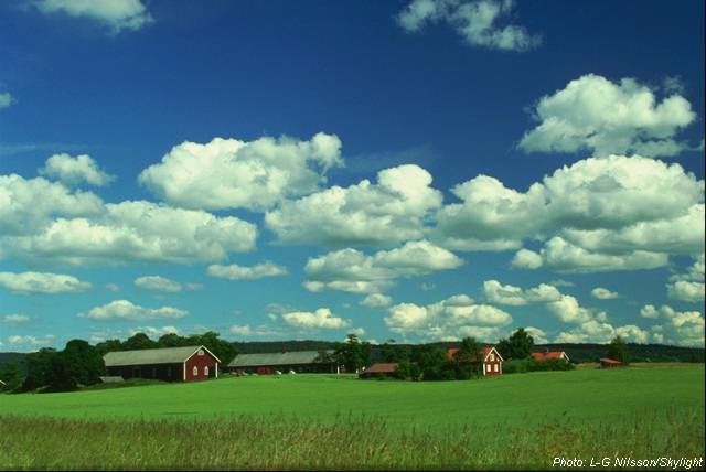
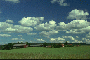
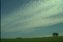
Cumulus humilis, fair-weather cumulus
|
|
|
Cumuli are typical summer clouds. When the sun is hot, warm air-bubbles rise from the ground like invisible hot air balloons. A few kilometres up in the atmosphere the water vapour in the bubbles condense into small water drops. Then small clouds form, shaped like lumps of cotton wool. Cumuli, which don't grow larger than those on the image here, bring continued calm weather for the rest of the day. The cumuli are dissolved in the evening when the sun is no longer providing heat.
|
|
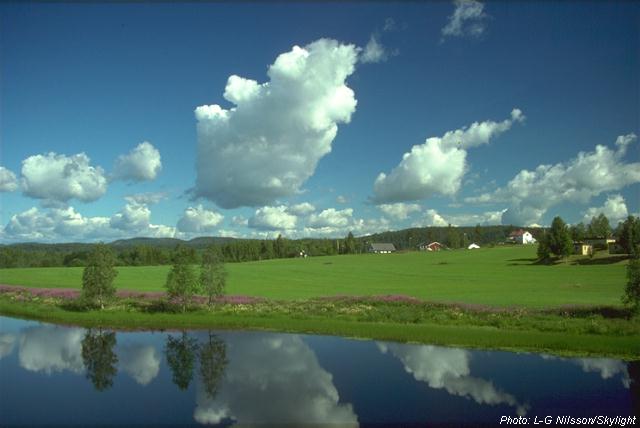
Cumulus congestus, piled-up clouds
|
|
|
If it is cold and moist in the atmosphere the cumuli can continue to grow. The clouds will grow as long as they are warmer than the surrounding air. Eventually they start to look like cauliflower and rise even higher in the sky. If the clouds are as large as on this picture by noon, there is a risk of showers in the afternoon.
|
|
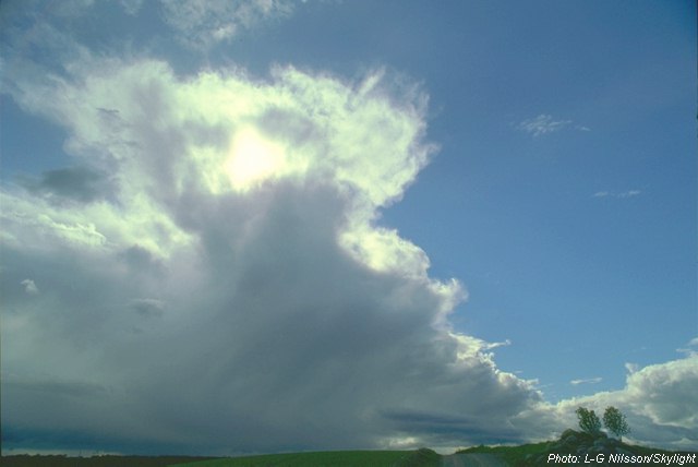
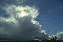
Cumulonimbus, thunder clouds
|
|
|
When the cumuli pile up high enough the drops of water at the top (at an altitude of 7-10 kilometres) freezes to small crystals. The top of the cloud then becomes stringy and anvil shaped. The lower part of the thick cloud looks dark and menacing. If this cumulonimbus approaches, a storm can quickly develop with dashes of rain, thunder, hail and strong gusts of wind.
|
|
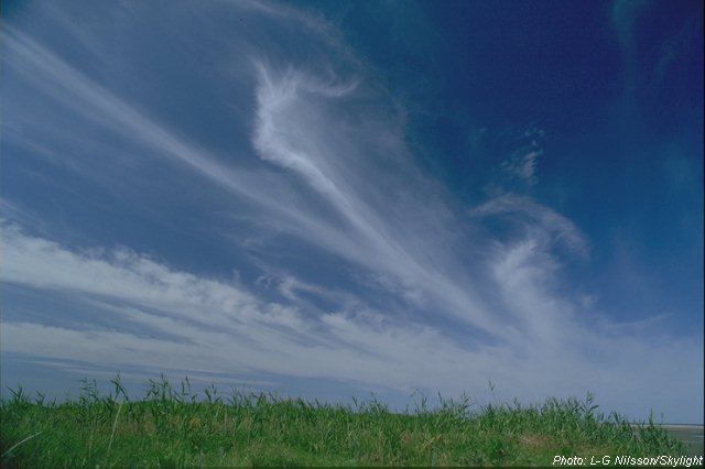
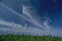
Cirrus uncinus, mare's tails
|
|
|
Thin white strings of cloud in an otherwise clear blue sky. They may not look threatning but watch out for hooks at the ends and the strings being thicker towards the horizon. If they continue to rise in the sky, a low pressure may be approaching. The precipitation may start within twenty-four hours. The cirri consists of small ice crystals and are usually at an altitude of 7-10 kilometres.
|
|
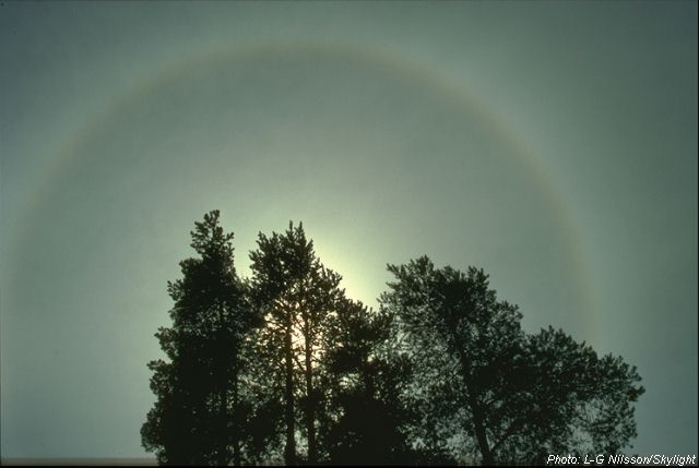
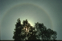
Cirrostratus
|
|
|
If the cirri are followed by a thin white veil of clouds eventually covering most of the sky, this is another sign of a comming low pressure. When the sun shines through the high veil of clouds, the small ice crystals of the cloud scatter the light. This makes a ring of light, called a halo, form around the sun. This phenomenon can be a sign of precipitation, probably within 12 hours.
|
|
Altostratus
|
|
|
When a low pressure approaches, the cirrostrati are followed by altostrati which are at a lower altitude (at 3-7 kilometres) and consist of drops of water. The sun shines through the cloud cover like through a matt pane of glass and soon disappear behind the ever thicker and greyer strata. If it looks loke this picture it may only be a matter of hours before the precipitation starts.
|
|
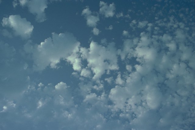
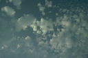
Altocumulus
|
|
|
Altocumuli are formed by rising hot air-bubbles or by turbulence in a layer of the atmosphere. The altocumulus consists of many separate cloud elements. Every cloud element coincides with rising air. In the stripes of blue sky between the cloud elements, the air is sinking. If you fly through an altocumulus cloud cover the rising and sinking air can feel shaky (turbulence). The altocumulus consists of drops of water and are at a medium high altitude (3-7 kilometres).
|
|
Altocumulus floccus
|
|
|
Bobbles of clouds like these give an uneasy impression when they appear in the sky. One can tell that the atmosphere is unstable. Big upheavals can be brewing. A squall-line may be approaching just beyond the horizon. Within a few hours a thick wall of dark clouds can roll in and bring heavy showers and thunder.
|
|
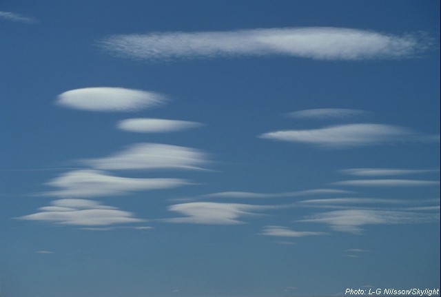
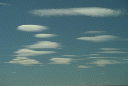
Altocumulus lenticularis
|
|
|
Sometimes pretty altocumulus lenticularis can appear in the sky. They are formed in the shelter of mountain ranges. When the wind blows over the mountains the air can move in waves for several hundreds of kilometres afterwards. In the peaks of the waves altocumulus lenticularis are formed. One condition for the forming of these clouds is a stable atmosphere. Therefore no dramatic weather changes can be expected.
|
|
|
| |
|
|